Wednesday, August 22nd
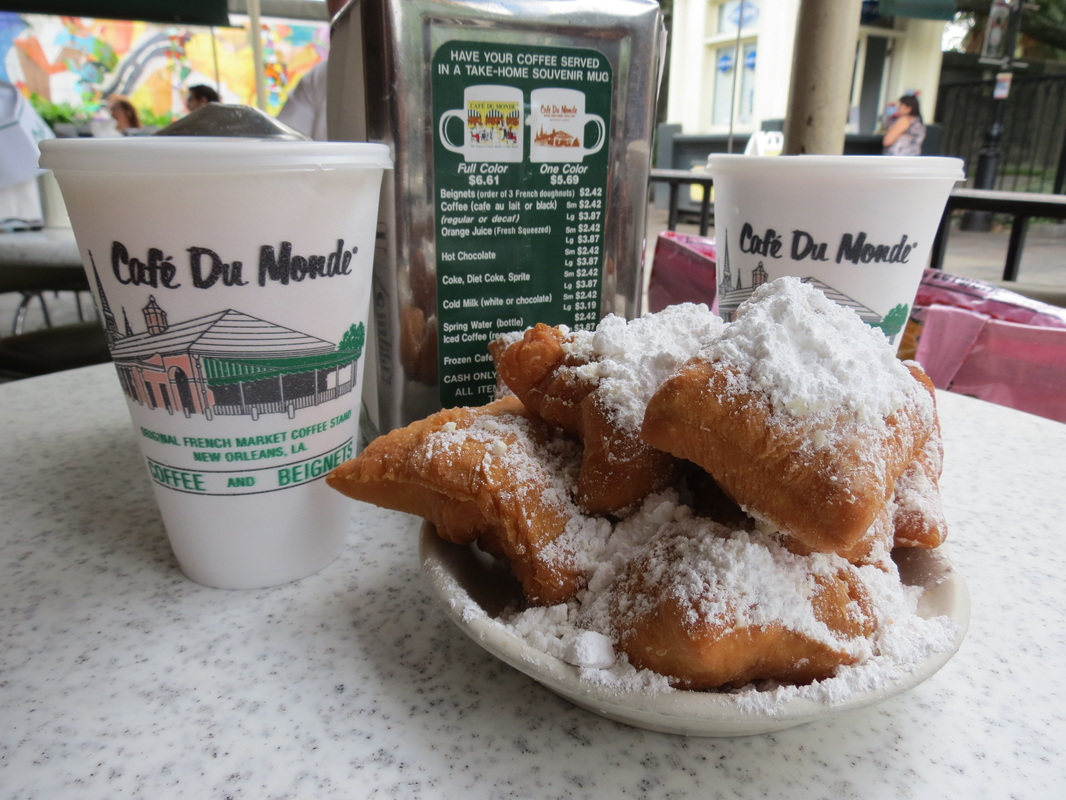
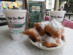 We started our final morning in New Orleans with the requisite trip back to Café du Monde for a delicious (though not nutritious) breakfast of beignets buried in a mountain of powdered sugar, as well as their famous chicory coffee to wake Charla up and, in anticipation of our arrival in the Sunshine State, some fresh-squeezed OJ for Chase. On our way out of town we drove across the 23-mile Pontchartrain Causeway. The bridge across Lake Pontchartrain is so long that allegedly one can see the curvature of the earth while crossing the bridge; unfortunately for us, a tanker truck was leaking corrosive chemical waste on I-10, which shut down the Interstate, and forced so much traffic onto the Causeway we didn’t get to see anything too exciting.
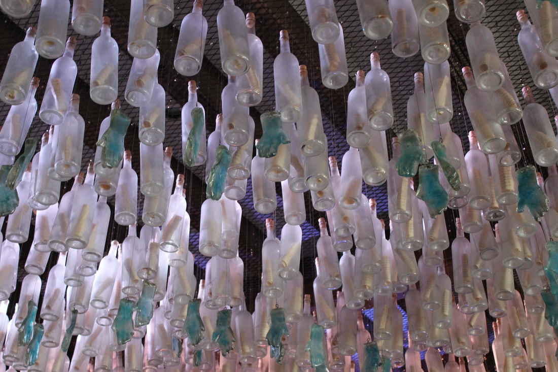
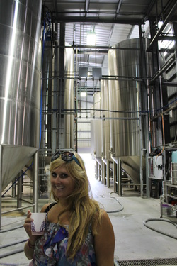 On the other side of Lake Pontchartrain, we finally arrived in Abita Springs, Louisiana, the home of Abita beer. The sweet smell of the brewery greeted us as we walked in to find the sampling room already open before our 2:00 tour. The tour of the facility started with two short videos, one about the brewing process and the other about Abita’s mission to go green, and then we were guided into the large room filled with tanks where our only instructions were not to touch anything shiny. The tour was short but informative, and most importantly, it left us with an even greater love of this Louisianan brew.
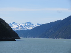
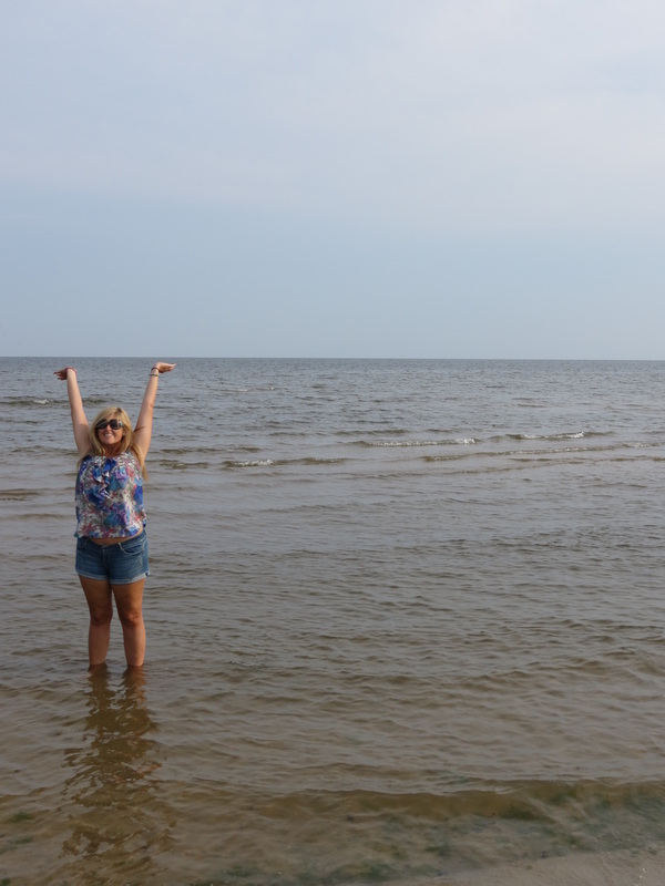
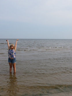 Leaving Abita we jumped on to I-12, to I-10, to the Mississippi state line and the shockingly nice Mississippi Welcome Center. Also near the Welcome Center is the NASA Infinity Center; the name sounded impressive yet vague, but when we arrived they had just closed and we didn’t end up learning anything more about it. Once we were in Mississippi we ducked off the Interstate onto US90, a scenic rural highway along the coast. In the town of Waveland we had a very exciting moment when we saw the Gulf of Mexico for the first time of the trip! We, of course, slammed on the brakes and waded out to play on Waveland Beach before continuing on east.
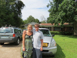 We stayed on US90 until the sun set, and once the views were gone we jumped back on I-10 for the long slog east. I-10 passed us right on through the 55 miles of Alabama and the 200 miles of the Florida Panhandle before finally arriving in Tallahassee at 2AM. Charla operated as our Tallahassee tour guide, pointing out both the sights and the day-to-day necessities of the city, until we stopped for the night to say hello to Charla’s mom and goodbye to our road trip from Talkeetna to Tallahassee.
Tuesday, August 21st
 We started out our day in the Crescent City by exploring the French Quarter. A bit of aimless wandering and we found ourselves at Jackson Square, anchored by Saint Louis Cathedral, and also the location of the Louisiana State Museum. There were two main exhibits in the museum; the first floor was a poignant remembrance of Hurricane Katrina from the tropical depression forming over the Bahamas all the way through landfall, flood control failure, personal struggles, recovery, urban replanning, forecasting science, and the engineering of present and potentially future flood control systems, while the second floor held a much more upbeat exhibit about the history of Mardi Gras and carnivals in New Orleans, including turn-of-the-century dance cards and invitations to the krewes’ formal balls.
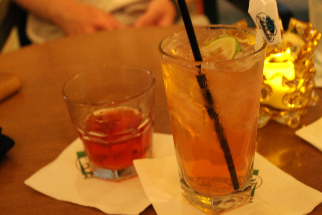
Leaving the museum we realized that we were getting a bit hungry for a late lunch, so our wandering began to include looking for a place to eat. After seeing more of the French Quarter, and even walking the famous Bourbon Street, we ended up at Johnny’s Po-Boys, consistently named one of the best po-boy restaurants in the city. The reviews did not lie, and our po-boys were delicious. After this mid-afternoon meal we wanted to rest for a bit, and headed back to the hotel to take advantage of the pool/hot tub/sauna and again watched the sun set over the Mississippi River from our room. 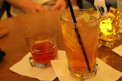 Refreshed and ready for a night out, we went downstairs, where we enjoyed bar food and cocktails at the Café Adelaide and Swizzle Stick Bar. The shrimp and tasso corndogs, shrimp and okra gumbo, and bacon encrusted oysters paired with an Adelaide Swizzle and a Sazerac made for a perfect last dinner in New Orleans (this time around).
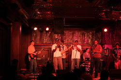 From the hotel, we walked through the French Quarter, where many bars and shops were already closed, for some reason we have yet to figure out. So, we headed for the music of Frenchmen Street, where we first went to the Spotted Cat Music Club. The Smokin' Time Jazz Club was playing in the window of the intimate club while swing dancers showed off their best moves on the floor. At the Spotted Cat, we met up with Charla’s classmate Paul, who is at the end of his forty-five-day journey around America on Amtrak, and his friends Kunal and Erin. While the band took a break, we stepped across the street to Café Negril, where we caught their funk band’s last song as they closed shop for the evening. Walking back towards the River, we found the Balcony Music Club, where a fantastic band was still rocking the house. Their set mixed some classic jazz tunes you would expect to hear in NOLA with some funky brass/rock hiphop tunes, like a cover of “Get Low,” that surprised and delighted the crowd. Our night started winding down, as we hung out at Molly’s to swap travel stories and then made our way to Café du Monde for a late night bag of beignets, which we ate as we walked back to the Loews.
Friday, August 10th 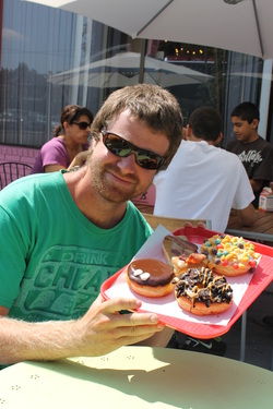 We started our day at Tiny’s, a trendy little coffee shop near Elliot and Brad’s apartment that featured delicious breakfast sandwiches and good coffee. There, we said good bye to Brad and made moves to our last stop in Portland, the city’s staple where good things come in pink boxes. We could not possibly leave without trying Voodoo Doughnut (Too)! When we pulled into the parking lot, Charla spotted a Voodoo Doughnut tuk tuk. She didn’t even need to try one of their creations before she was in love. We waited in the short line (much shorter than the one wrapping around the block in front of the original Voodoo shop we had checked out on our first night) and then faced a difficult decision: what to order? Chase settled on the Portland Cream and the Maple Bacon Bar (yes, that’s bacon on a doughnut!) while Charla went the sweet route with a Captain My Captain, covered in Cap’n Crunch cereal, and an Oreo King, topped with Oreo crumbles and chocolate.
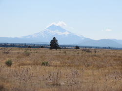
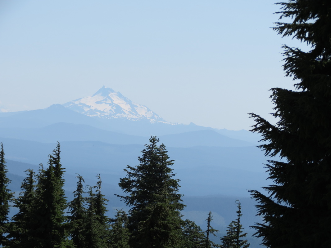
 A few miles on I-84 led us to Highway 26, a scenic road that took us through Mt. Hood National Forest. To get an even better view of the snow topped mountain, we cruised up to Timberline Lodge. There were skiers and riders walking around the lodge, and Chase started aching for a ride. If only the winter gear were more accessible in the Pilot right now! Meanwhile, Charla was channeling her inner film buff and getting a little scared just thinking of The Shining, which filmed its outside shots here.
 After leaving Timberline and driving southeast, we started to experience a dramatic change of topography and temperature. From the cool mountain climes that promoted the growth of much greenery, we entered into the hot and dry high desert where the only green we saw grew up around irrigation systems. Coming into Bend, we came back into a lot of vegetation, as the Deschutes River and National Forest are nearby.
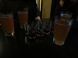
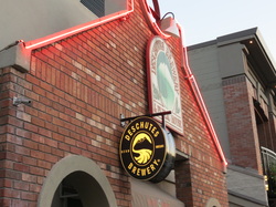 Miles back, in Kirkland, Washington, Charla spotted her first Jimmy John’s since returning from Southeast Asia, but we went out for a great Thai meal with Alison instead. The craving had not gone away, so we went straight to Jimmy’s when we arrived in Bend. After loading up on sandwiches, we walked around downtown and the riverside before going to the Deschutes Brew Pub to sample the local brews. In addition to the Chainbreaker White IPA and Spencer’s Gold Ale, the bar staff gave us directions to a camping spot in the National Forest. We ended up pulling off the road a bit before their favorite locale by Tumalo Creek for a good place to watch the Perseid meteor shower that was just getting into swing.
Monday, August 6th
BC Day!
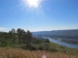 _ We woke up early as we experienced a HOT morning in the tent for the first time on the trip. The sun was baking down on our overlook, and our tent, but it was also creating a magical view overlooking the entire Peace River Valley. We had a simple “eat-it-before-it-goes-bad” breakfast of yogurt and cereal with milk before packing up our camp. While we were packing up, our overlook became a very popular rest stop. A motorcyclist from Grande Prairie was taking in the view and chatting up a local lady, meanwhile four support vehicles pulled into the overlook. Curiosity got the best of us, and we discovered that we were about to be a checkpoint on an 800-kilometer bicycle journey called Bikers for Bibles who were raising money to translate Bibles into local First Nation languages. We decided we should get out of there before we got swarmed with sweaty bicyclists.
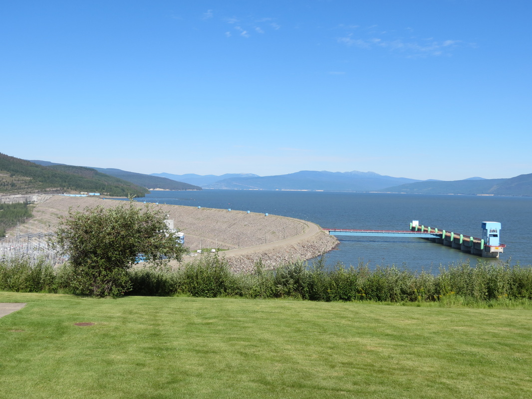
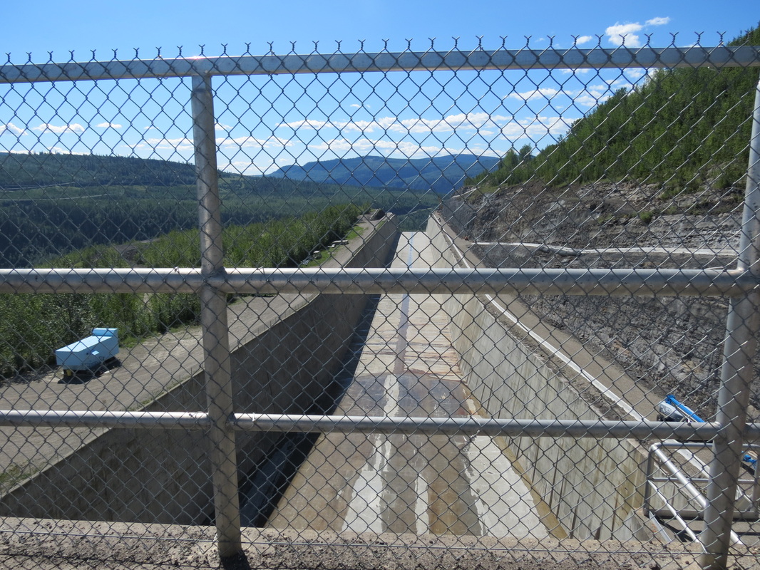
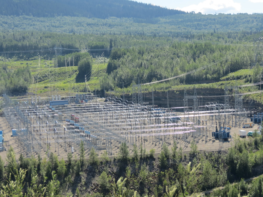
_ Our first stop was at the W.A.C. Bennett Dam, the most massive earthfill structure in the world, operated by BC Hydro. We took an underground bus tour into the dam itself, where we found ourselves 500 feet underground inside a dam. Luckily for us, one of the turbines was out of commission for maintenance, and it was on our tour route. The entire turbine was taken apart and we got to see all of the massive parts and pieces. And we mean massive; the underground chamber holding the turbines was as long as three football fields and as tall as the observation deck of the Eiffel Tower. The next stop on the tour was the dam manifold, roughly equivalent in purpose and use as a massive version of the manifold on a car’s exhaust. Once the water was done producing electricity, all the turbines spat the water into the same manifold, along with the seepage water that was naturally coming through the earthen structure of the dam. Interestingly, the seepage water reinforces the strength of the earthen fill of the dam, much like building a sand castle with wet sand rather than dry sand. (They didn’t allow cameras on the tour, so you’ll just have to trust us on how cool it was.) After the tour we discovered that it was possible to drive across the crest of the dam itself, so of course we took advantage of that opportunity. 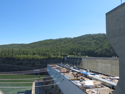 _ Our next stop was the Bennett’s baby sister dam, the Peace Canyon Dam. Though there was no way to get into the dam itself, we were able to watch a fascinating video called “Wide Load North” about transporting a nine-meter-wide, 250-ton steel turbine runner from Leningrad to Vancouver and up to the Peace River. They constructed a 21-axle, 130-wheel, two-engine Mack truck to haul it 600 kilometers over road, most of which was built specifically for this project as nothing that large had ever traveled through northeastern British Columbia before. After the Peace Canyon Dam we got to see some of the less-than-awesome elements of dams. We had lunch by lovely Dinosaur Lake, which was a beautiful spot teeming with locals. Hudson’s Hope’s two claims to fame are dinosaurs and dams. They had discovered a brand new species of dinosaur, as well as 1,700 dinosaur tracks in over 150 different trackways. The very next thing they did was bury all evidence of dinosaurs under a lake created by the Peace Canyon Dam; luckily they did at least name it Dinosaur Lake in honor of the footprints hundreds of feet under water.
 _ We were also pleasantly surprised to discover that today is apparently a major holiday in British Columbia: BC Day. We happened to arrive at the W.A.C. Bennett Dam to be told that all dam tours were half price; then we stopped at a Post Office that was mysteriously closed; then we had lunch at a very crowded park for a Monday. It wasn’t until hours later that we heard on CBC that it was BC Day today, and it all made sense. (We also learned from CBC that today is the 50th anniversary of the day Jamaica gained its freedom from England; a little late compared to us, but happy 50th birthday anyway Jamaica!)
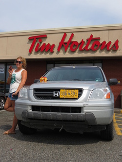
From Dinosaur Lake we really hit the road and made it all the way to Prince George, “the capitol of Northern BC.” (Though Charla was quick to point out that seeing as how we had been driving south through BC for two days now, this should hardly count as “north.”) Prince George is really where the drive returns to civilization, for better or for worse. There are traffic lights and four-lane highways, as well as big box stores with names such as Canadian Tire (which has much more than just tires) and The Great Canadian Superstore (which seems to have every product imaginable with the notable exception of beer). In better news, Prince George also featured Tim Horton’s, the Canadian staple of fast-food donut eateries. Since Charla had never eaten at a Tim Horton’s before, we of course had to stop. After snacking on donuts and coffee, it was time to be back on the road heading south to our roadside stop in McLeese Lake for the night.
Saturday, August 4th
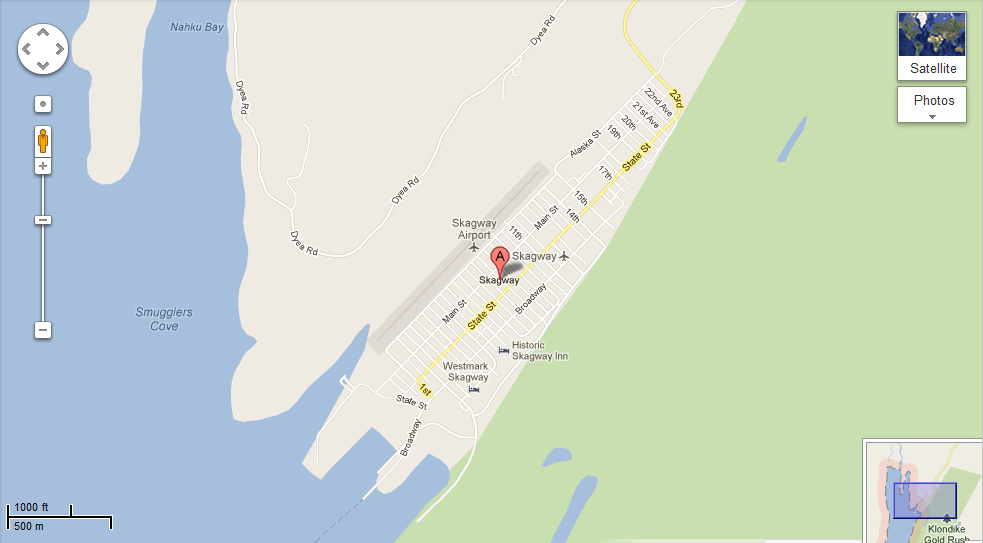
 _ Much to everyone’s surprise (especially the local Skagwegians), we woke up to a beautiful sunny day! We explored town a bit more, including a walk down to the cruise ship dock, where a new boat had unloaded its happy passengers earlier that morning. From the dock, we had some sweet views of the Tracy Arm. Then, we made our way back into town for some pan au chocolate at Glacial Smoothies and Espresso. Noticing an ad in the Skaguay Alaskan paper in the coffee shop, we stopped in a store nearby for a free train whistle with the purchase of some snazzy bear socks. In times of radio silence while driving through massive British Columbia, the train whistle certainly came in useful (without much success, we both attempted playing songs ranging from Lady Gaga’s “Born This Way” and a smattering from Lonely Island).
 _ After much hugging and a few high fives at the Attic, we started the scenic drive out of Skagway through White Pass, climbing some 3,000 feet in just nine miles and crossing the Canadian-America border one more time.
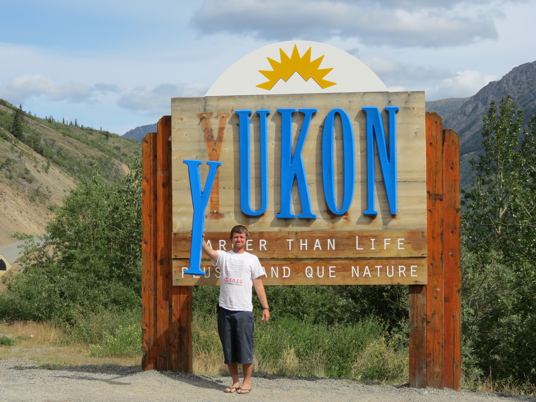
 _ We crossed from BC into the Yukon, where we happened upon the deserted Venus Mill mining structure on Tutshi Lake. Built in 1908, it was meant as a last-ditch effort to try to mine silver from the lake, but it was unsuccessful. Later on we crossed through Carcross (from the original town’s name CARibou CROSSing) and then the Tagish Road onto the Alaska Highway for the third and longest stretch of our trip.
 _ We made a quick stop in Teslin for gas and groceries before making a nice lunch overlooking Nisultin Bay just outside of town. With a full tank in the trusty Pilot and full stomachs, we covered a lot of ground before reaching the Watson Lake Signpost Forest. We meandered around a bit and made the necessary stops to check up on Chase’s two signs there. We skipped out on the Northern Lights Centre, deciding that we would just have to wait until our return to Alaska to see them again in the sky and not on film. From there, we drove for a bit and started seeking out a place to rest for the night. Our first stop was place we will forever call mosquito land. We took a turnoff, hopeful for a nice spot, but it looped around back towards the Highway. We found what appeared a nice spot in the back of the loop, but after a few minutes of setting up the tent, we were swarmed with plaque-like quantities of mosquitoes and quickly decided to pack it all in and search for something better. We stopped in a rock quarry a few miles down the road that was still fairly mosquito-infested but a much better option for a place to make dinner and get some rest.
Friday, August 3rd
 _ We woke up among the Klondike gold rush-era facades of the Attic, as Freddie’s apartment complex is known among the residents. Once again it was time for more blueberry pancakes using Charla’s blueberries from Talkeetna! (Readers might have noticed that by now they’ve been smuggled across a second international border, so we should get around to eating them.)
 _ After filling up on pancakes we ventured into town to discover that Skagway receives a lot of rain. And wind. And clouds. And 600,000 cruise ship visitors a year in a town of 900 people. Like the cruise ship people, though far more appreciative of their services, we visited the National Parks Service visitors’ center to start our day. After exploring town (which essentially constitutes walking from one end of Broadway to the other) we returned to the Attic for lunch and were pleasantly surprised when Freddie got off of work early and came back to join us.
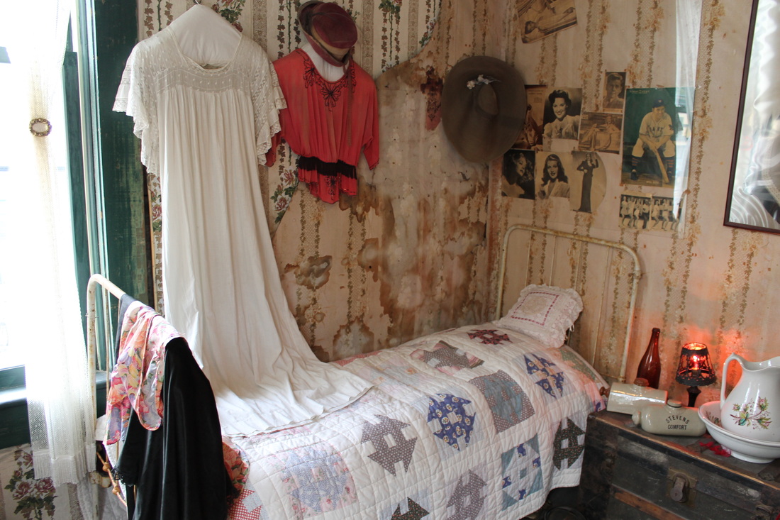
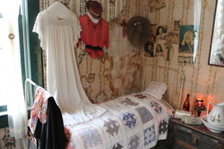 _ We spent the rainy afternoon getting to know Freddie’s roommates and coworkers, and then ventured back into town for a stop at the local brothel. The Red Onion was Skagway’s brothel back during the gold rush days of the 1890s (and a post office, telegram station, military barracks, etc., before becoming the museum it is today; hence, the 1940's and 50's pinups on the walls), and the fully-functional bar gives tours of the upstairs where the girls never missed a trick. Today it costs $5 to get upstairs for 15 minutes, which is the exact same that it cost in 1899.
 _ Before departing on the trip we had become accustomed to Burger & Brew at the West Rib Pub in Talkeetna on Friday nights, where you get a burger and a PBR for $6.95. We were adrift in Skagway without our Friday night staple, until a whispered rumor sent us to Jewell Gardens for Friday night Hippie Hour where the burgers are $5 and the PBRs are $2. Though an extra nickel changed hands, we were able to keep up the Friday night tradition!
 _ After dinner, we started up a new Friday night tradition at the Skagway Brewing Company. Well, perhaps not a tradition since it won’t happen again, but we all wish it was a tradition. The BrewCo was offering 75 Cent Mystery Shot night, which we descended upon with Freddie and a couple of his roommates. In addition to 75 cent shots, the BrewCo also had its signature Spruce Tip Blonde back on tap, a favorite of ours after sampling a brown and an IPA the night before. After a wild time at the BrewCo (where we were the only table ordering mystery shots and also the only table being wild) we made a quick stop back at the Red Onion. A lowly brothel by day, the RO turns into a dance club at night, luring in the likes of a bachelorette party all the way from Whitehorse.
Wednesday, August 1st
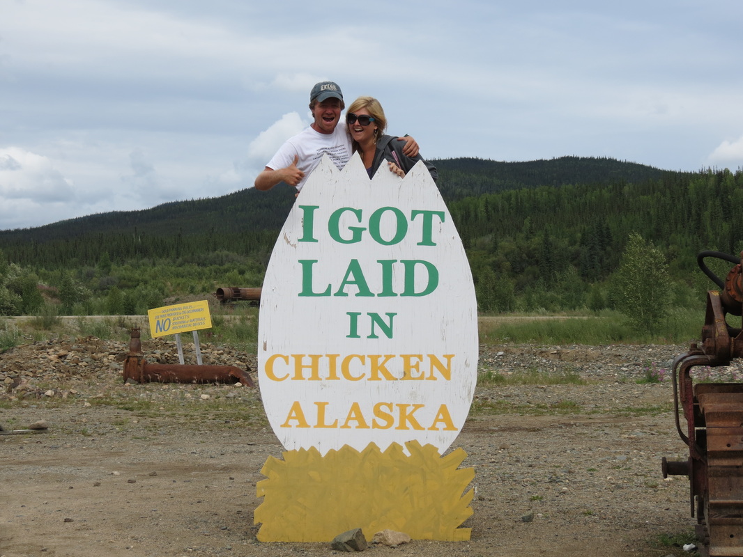
 _ We started the second day of our trip with pancakes made with fresh blueberries and strawberries that Charla picked with Sarah and Logan on Monday afternoon. While Charla was busy at the camp stove, Chase re-packed the Pilot so what we needed was easy to reach and what we didn’t need on this trip (like a snowboard and winter gear) was organized and out of the way. We drove into Tok for gas and some errands, including phone calls before our service cut out (even though Tok is 80 miles from Canada, there isn’t a lot going on in the space between the small town and the border). On the way to Tok, we had a nice surprise and saw a lynx! After ten miles on the Alaska Highway out of Tok, we got on the Taylor Highway to Chicken. Our journey into Chicken started with a big disappointment, as the “Chicken Community” sign formerly covered in an assortment of stickers from travelers had recently been replaced. It was brand spanking new, with the Department of Transportation laminate still peeling off on the corners. Things got better once we got into town, and we got laid in Chicken! We also picked up free chickens that we had earned and met a couple Romanian motorcyclists who were journeying across North America on their own bikes from home. We had one last stop at Downtown Chicken for gas, and luckily for us we paid up and were ready to leave just as two busloads of Princess tourists pulled up to Downtown. The tourists slowly waddled off the bus, cameras in hand, to invade Chicken as we sped out of town.
 _ But we didn’t speed too quickly, as the Taylor Highway ascended up into the mountains and grew increasingly hairy. Just a short time before we passed, a large RV motorcoach with a car in tow had rolled off the side of the mountain and come to rest approximately 150 feet below the road. The Troopers had already cordoned off the scene so we didn’t stop to investigate ourselves, but it didn’t look like a rollercoaster ride we’d have wanted to experience.
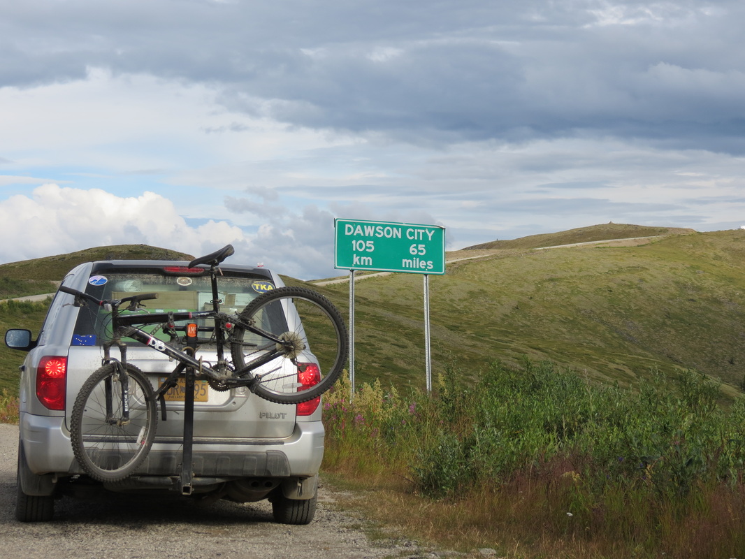
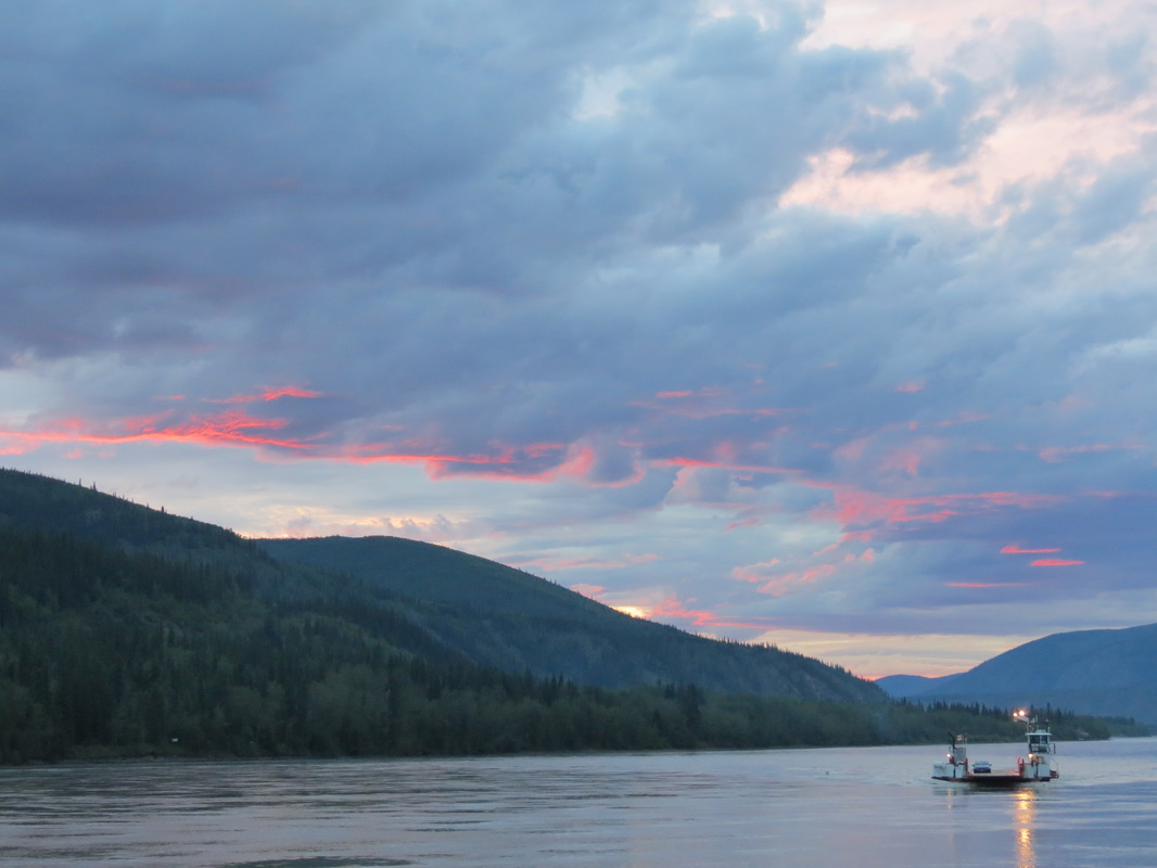
 _ The Taylor Highway becomes the Top of the World Highway as the road becomes Canadian. Luckily we were let across the border without too hard a time from the Canadian Border Security Agent on duty (even though we were smuggling some more of Charla’s freshly-picked berries). We had been foolishly using our time earlier in the day, so we cautiously drove as fast as we dared along the beautiful and treacherous road to Dawson City. Arriving just in time to jump on the George Black, the free ferry across the Yukon River (because the Yukon territorial government hasn’t yet gotten around to building a bridge) we made it to Diamond Tooth Gertie’s just in time for their first can-can show of the evening. Gertie’s is Canada’s oldest casino from before casinos were legal in the Klondike gold rush of the 1890s, and today in addition to gambling Gertie’s offers shows throughout the evening. Told by Diamond Tooth Gertie (the actual proprietor in the 1890s, who actually did have diamonds in her teeth at the time) and her dancing girls, the show tells us how she met Phineas and all the hilarity that ensues. After a dinner between shows at the Triple J Hotel, and the second show at Gertie’s, it was time for one last hop across the ferry to camp in West Dawson.
Tuesday, July 31st
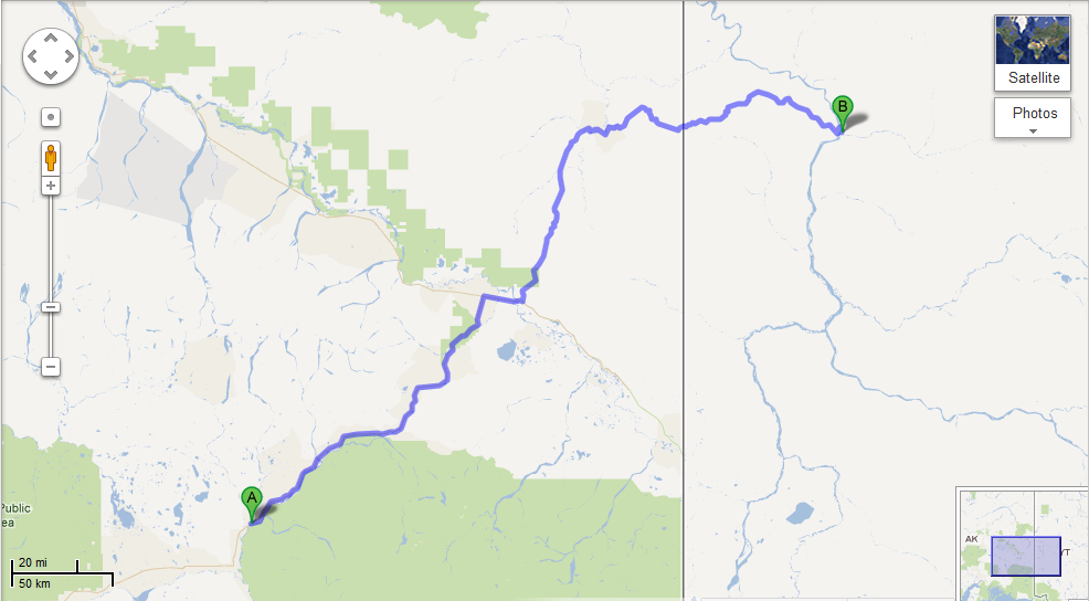
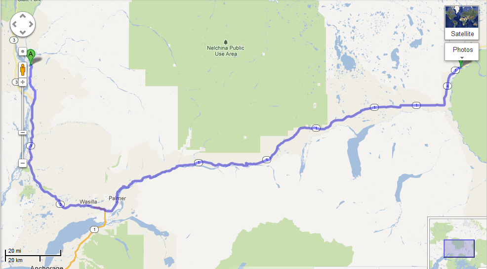
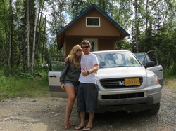 _We got a late start out of Talkeetna after a rush job of packing all of Chase’s worldly possessions into the back of a Honda Pilot. Luckily, Alex and Paul were also hanging out at the cabin for company and moral support (and loading some of Chase’s stuff that wouldn’t fit into Mugly, Alex’s truck, to take home to Seward). Once everything was loaded and ready to go, it was time for one last run into town. Ostensibly, the run into town was for a growler of beer from Denali Brewing Company and bag of baked goods from the Talkeetna Roadhouse, but you can’t make it on to Main Street without running into everyone you know. After a hearty round of goodbyes (as well as a growler and some baked deliciousness) we were finally on the Talkeetna Spur Road heading out of town. Once on the Spur, we started our epic game of “finding license plates from every state and province.” (Click here for updates on how the game is going and where we’re finding the different plates.) We got a bunch of them right away heading south on the Parks Highway.
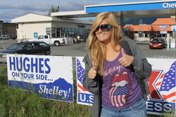 _After the requisite and dreaded stop at Fred Meyer in Wasilla for supplies and a stop in Palmer for gas, we were on our way! (And look who decided to run for office at the gas station! No, no, the sign’s actually for Shelley Hughes who’s running for the State House.)
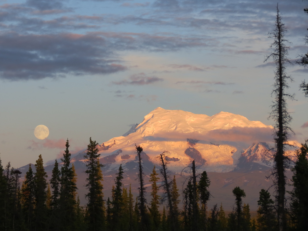
 _ A nice drive east on the Glenn Highway led us through the Chugach Mountains and past Matanuska Glacier. After taking the left to Canada in Glenallen on the Richardson Highway, the full moon started rising over Mount St. Elias and the mountains exhibited an amazing alpenglow. Twenty-one miles into the Tok Cut-Off we found a great spot to hunker down for the night with bathrooms and picnic tables and all!
|


 RSS Feed